Back n' Time Antiques and Americana
1970s Rand McNally Dist-O-Map Mileage & Destination
Item #: BNT2915
Our price: $17.00
|
|
|
|
Details
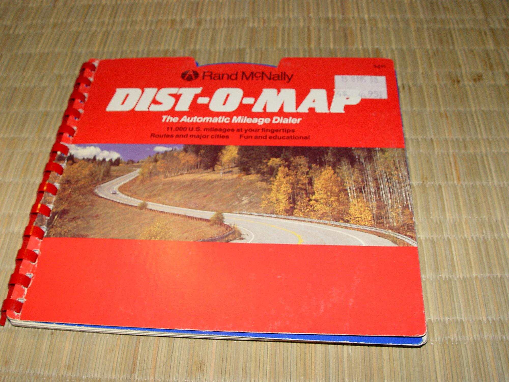
A fun novelty from days when folks enjoyed the open road more.
This travel trip planning atlas was issued by the travel
publishing company, Rand McNally. This reminds us of a time when
sights and sounds of the open road carried us anywhere we wanted
to go in this United States. Believed to date to the late
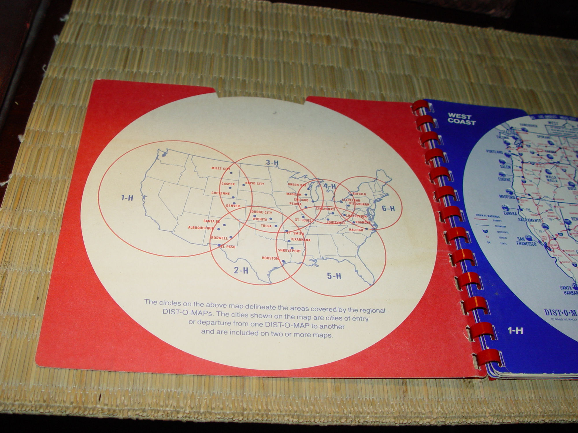
1970s. There are instructions on the inside of the back
cover stating that 1st; the Dist-O-Map performs point to point
distances, 2nd; the best highway numbers to follow to your
destination
and 3rd; shows distances between principal cities along primary
routes and aids in planning refueling stops, meals and overnight
stops.
Measures approx. 8 in by 7.5 in
Six pages
Each page includes a wheel that spins freely and shows various
starting points within the region. Mileage numbers within the map
change according to the starting point selected. Functions very
well. Has the original price tag in the upper right hand corner,
front cover. Spiral bound. Very clean inside and out.
Please email with any questions you may have. Thanks for looking
Check out and Like our

Page!